
First up is a Paintable and Printable World Map where you can select countries to "paint" or colorize, zoom in and out, and then print the end result. Here's a quick screen-shot of the map tool with a few countries colored:
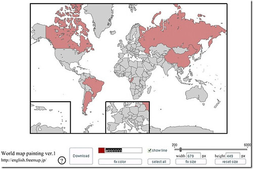
Note the tools at the bottom of the page where you can customize the map, download or print.
Check out the Paintable, Printable World Map HERE
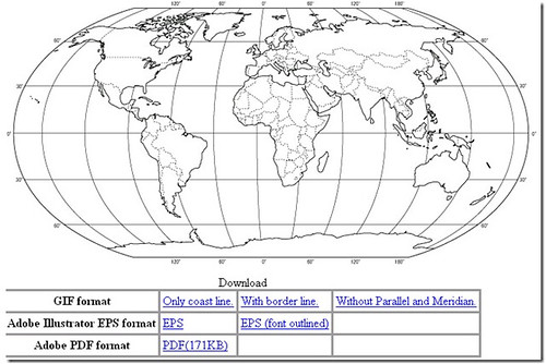
There's also a printable (robinson projection) world map you can print or download.
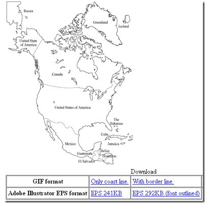
How about a simple map of the America's like this one:
Check out the entire selection of maps by CLICKING HERE
If you like maps and geography, you'll love geography tetris--read about it here.
I love maps mashups - read about all of them I've covered HERE
SUBSCRIBE TO THIS BLOG IN RSS READER
SUBSCRIBE TO THIS BLOG BY EMAIL